Due to the inherent limitations of underwater environments, such as limited visibility and electromagnetic signal attenuation, underwater geolocation is a difficult task. However, recent technological advances have investigated the use of polarisation patterns to enable new geolocalization techniques. This new field has the potential to improve underwater navigation, mapping, and tracking capabilities.
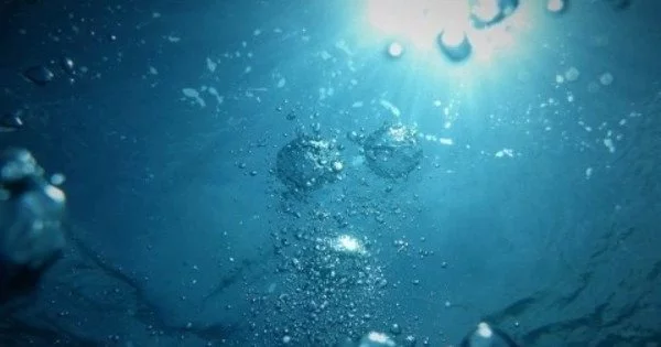
A hidden world exists beneath the water’s surface, one that cannot be seen with the naked eye. However, when viewed through a special camera, rich polarisation patterns emerge. These patterns can be used as an alternative approach to geolocation, which is the process of determining an object’s geographic location.
Researchers at the University of Illinois at Urbana-Champaign have created a novel method for underwater geolocation by training deep neural networks on 10 million polarization-sensitive images collected from around the world. This new study, led by Viktor Gruev, professor of electrical and computer engineering, and David Forsyth, professor of computer science, enables underwater geolocation using only optical data while also providing a tool for tethered-free underwater navigation.
This research was recently published in the journal eLight.
It is an incredibly challenging problem to have a free-moving, underwater vehicle. The way we solve this problem is by developing specialized cameras and machine learning algorithms. By combining those, we can actually figure out the sun’s location and this is where polarization imaging comes into play.
Victor Gruev
“We are demonstrating for the first time that you can geolocate yourself or a camera in a variety of conditions, whether in open ocean waters, clear waters, or low visibility waters, during the day, at night, or at depth,” says Gruev. “Once you know where you are, you can begin exploring and using that information to gain a better understanding of the underwater world or even how animals navigate.”
According to Gruev, one of the major challenges with underwater navigation and geolocation is that GPS signals cannot penetrate water and instead bounce off the surface. “We’re completely blind in terms of GPS signals underwater.” For underwater geolocation, we must employ a variety of methods and technologies.”
The current geolocation standard relies on acoustic information, which is primarily obtained through sonar technology. This is accomplished by deploying a large number of small sonar beacons that send triangulated signals to locate an object underwater. The problem is that sonar only works in a small, defined area and is also limited in its accuracy.
Another method currently in use is the use of submersibles tethered to a larger vessel above the surface with a GPS signal. Although the submersible can move slightly, it is ultimately constrained by the movement of the vessel.
“It is an incredibly challenging problem to have a free-moving, underwater vehicle. The way we solve this problem is by developing specialized cameras and machine learning algorithms. By combining those, we can actually figure out the sun’s location and this is where polarization imaging comes into play.” – Victor Gruev
The sun’s light waves travel in all directions; it is unpolarized. When those waves pass through a filter, such as the surface of the water, they are forced to move in only one direction–the light has been polarised. Polarisation patterns are caused by light passing through the air and being scattered by water molecules and other particles. The patterns underwater change throughout the day, and they are affected by the observer’s and the sun’s location. It is possible to determine location by analysing these patterns alongside accurate date and time information.
The team collected ~10 million images with an underwater camera and an omnidirectional lens capable of recording the polarization patterns from four sites: a freshwater lake in Champaign, IL (visibility around 0.3 m), coastal sea waters in Florida Key, FL (visibility around 0.5-3 m), sea water in the bay of Tampa, FL (visibility around 0.5 m), and a freshwater lake in Ohrid, North Macedonia (visibility exceeding 10 m). Images were taken in a variety of conditions (clear vs murky waters), depths, and times of the day- even at night when underwater light intensity is significantly weaker.
“We think of life as dull if we can’t see anything, if we cannot see the hands in front of us. But if we can see polarization properties of light, we can geolocate, even in muddy waters. And actually, life is pretty rich in terms of polarization,” Gruev says.
These images were used to train a neural network, which is an artificial intelligence method for learning and improving accuracy over time. “The way we did this was to collect 10 million images of the sun from underwater,” Forsyth explains. “Each image was tagged with the location and elevation of the sun.” These images were then fed into a learning system, which was tweaked until it provided a precise location.” Using these machine learning techniques has improved location accuracy to 40-50 km, with the potential for even greater accuracy.
This technology presents new opportunities for people and robots to navigate underwater. Oceans account for over 70% of Earth’s surface area, yet very little is known about it. Data we do know about these bodies of water comes from monitoring via satellites 20-30 miles above the surface. In situ autonomous sampling robots could provide more precise monitoring of water properties such as water temperature, salinity, oxygen levels and other related parameters.
The recent OceanGate Titan submersible search and rescue efforts highlighted the importance of precise geolocation capabilities. Due to the limitations of current technology, efforts were divided into two distinct regions, near the ocean surface and near the seafloor, in order to locate the submersible at any possible depth. Deep water operations are far more difficult than near-surface operations, which have more technological options and rely primarily on sonar. Sonar is not only unreliable over a large area, but it also frequently generates echoes that obscure an object’s precise location.
Gruev says, “This polarization imaging technology will enable smaller autonomous robots to roam around the first 200-300 meters where light penetrates into the water and where our technology works very well and can help during search and rescue missions.”