close

Geography

Geography

The 2022 Tongan Volcanic Explosion was the Largest Natural Explosion in Over a Century, According to a New Study

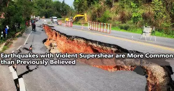
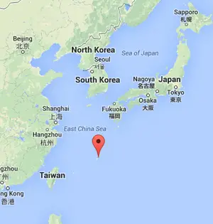
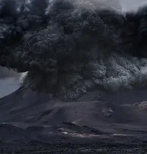
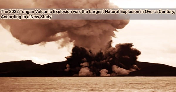
According to a new study led by scientists from the University of Miami Rosenstiel School of Marine, Atmospheric, and Earth Science and the Khaled bin Sultan Living Oceans Foundation, the 2022 eruption of an undersea volcano in Tonga was more powerful than the biggest nuclear detonation in the United States. The 15-megaton volcanic explosion from Hunga Tonga-Hunga Ha'apai, one of the largest natural explosions in more than a century, caused a mega-tsunami with waves up to 45 meters (148 feet) on Tonga's Tofua Island and 17 meters (56 feet) on Tongatapu, the country's most populated island. Rosenstiel School researchers created
Geography

According to a Study, Indigenous Territories and Protected Areas are Essential for Maintaining the Brazilian Amazon’s Forests

Time series satellite images from 2000 to 2021 were analyzed in a study led by researchers with the Center for Earth Observation and Modeling at the University of Oklahoma. The results showed the critical importance of Indigenous territories and protected areas in Brazilian Amazon forest conservation. The study's findings, which were recently published in Nature Sustainability, highlighted the detrimental effects of the government's newly weakened conservation laws. The Brazilian Amazon is home to the world's largest tropical forest and richest biodiversity. Since 2000, Indigenous territories and protected areas have increased substantially in the region, and by 2013; Indigenous territories and
Geography

Earthquakes with Violent Supershear are More Common than Previously Believed

According to a study headed by UCLA geophysicists and published today in Nature Geoscience, powerful supershear earthquakes, once thought to be rare, are significantly more prevalent than previously believed. The scientists analyzed all 6.7-or-greater magnitude strike-slip earthquakes worldwide since 2000 there were 87 in all and identified 12 of the supershear type or about 14%. (Four of those earthquakes were previously unreported.) Less than 6% of strike-slip earthquakes had previously been classified as supershear, which means that this percentage is more than twice what experts had anticipated. When the margins of two tectonic plates collide sideways, strike-slip earthquakes result. Supershear
Geography

‘Mega-Earthquake’ Started by Impact That Killed the Dinosaurs Lasted Weeks to Months

A 10-kilometer asteroid that struck Earth 66 million years ago caused the demise of the dinosaurs. According to recent research, the Chicxulub impact also produced an enormous earthquake that shook the earth for several weeks to months after the collision. This “mega-earthquake” is predicted to have released 1023 joules of energy, which is nearly 50,000 times more energy than the magnitude 9.1 Sumatra earthquake in 2004. Hermann Bermúdez will present evidence of this “mega-earthquake” at the upcoming GSA Connects meeting in Denver this Sunday, 9 October 2022. Earlier this year, with support from a GSA Graduate Student Research Grant, Bermúdez
Geography

Hillslope “Connectivity” is Mainly Driven by Tectonics, According to a Report

Given that hillslopes make up about 90% of the Earth's surface, chances are excellent that most readers are located on one. Hillslopes are important landscape elements that carry sediments and nutrients, connect terrestrial and aquatic habitats, and flow water from ridges down to valleys. A new large-scale analysis of hillslope connectivity at the continental scale from the University of Kansas was recently published in Geophysical Research Letters. The study contributes to a better understanding of the mechanisms through which hillslopes influence landslides, floods, and the development of wetlands. “'Connectivity' describes the likelihood that a part of the landscape is linked
Geography

During the Previous Ice Age, the Bering Land Bridge Formed Remarkably Late

The Bering Land Bridge, also known as Beringia, was a land bridge that connected present-day Siberia and Alaska during the last ice age. It formed about 20,000 years ago, when sea levels were much lower due to the large amount of water that was locked up in the ice sheets. As the glaciers began to melt and sea levels rose, the Bering Land Bridge was eventually submerged, forming the Bering Strait. The Bering Land Bridge played a significant role in human history, as it is believed to have been the route by which humans first migrated from Asia to North
Geography

Report provides Plans for a significant Investigation into the Geologic Dangers in Subduction Zones

We live on a dynamic planet that is constantly in motion at multiple scales, from changing daily weather patterns to the shifting of massive tectonic plates. Despite this, the Earth's geological activity is highest in areas where these tectonic plates collide, known as subduction zones. Subduction zones, where one tectonic plate slides beneath another, produce the most devastating seismic, volcanic, and landslide hazards on the planet. A new report proposes an ambitious plan to make significant advances in understanding subduction zone hazards by bringing together a diverse community of scientists in a long-term collaborative effort, deploying new instrumentation in subduction
Geography

In the latest Earth System Models, the Amazon Rainforest is dying as a result of Climate Change

As habitat destruction trends interact with climate change, there is concern that the Amazon will become entangled in a series of "feedback loops" that will dramatically accelerate the rate of forest loss and degradation, bringing the Amazon Biome to a point of no return. This threshold, also known as a tipping point, may occur when Amazonian forests die and are gradually replaced by fire-prone brush and savanna (ecological tipping point), and rainfall is inhibited on a regional scale (climatic tipping point). The Amazon rainforest's dieback has long been touted as a possible climate tipping point, despite the fact that only
Geography

Events of Low Ocean Oxygen and Volcanic Activity Associated with Climate Warming and Rapid Ice Melt During the Last Ice Age

During periods of fast global warming at the end of the last ice age, volcanic ash and hypoxia a low ocean oxygen gap lasting thousands of years consistently paired during sediment cores from the North Pacific Ocean, according to a new study. Important issues about what might happen as the globe warms today are raised by the relationship between volcanic activity, hypoxia, and glacier melt brought on by warmer temperatures during the previous ice age, which ended around 18,000 years ago. “It is unknown right now whether volcanic eruptions will increase as the climate warms,” said the study's lead author,
Geography

Great Barrier Reef and Australia’s K’Gari Sand Island were Formed, According to Scientists

How did the Great Barrier Reef, the largest coral reef in the world, and K'gari, the indigenous name for eastern Australia's Fraser Island, the largest sand island in the world, come to be? There is little known about how these UNESCO World Heritage sites came to be, despite the fact that they have been shaped by a stable, long-lasting tectonic history spanning the Quaternary period, which started 2.6 million years ago. However, recent research by geoscientist Tammy Rittenour of Utah State University and a global group of colleagues points to a contemporary issue that may have contributed to the origins