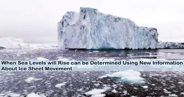
Nearly half of the fresh water in the northern hemisphere is contained in the huge Greenland ice sheet. But as Earth’s temperature rises, the planet is melting and the oceans are rising. As such, the ice sheet’s movements are closely monitored.
Using extensive satellite measurements, researchers from the Geological Survey of Denmark and Greenland (GEUS) and the University of Copenhagen’s Niels Bohr Institute have conducted a study that shows how movements of the ice sheet appear to be closely linked with meltwater flow beneath the ice.
The researchers used artificial intelligence to analyze ice movements, which they can now categorize into four groups based on movement patterns. The study’s authors claim that we haven’t fully understood why the velocity of ice at a given location might fluctuate over time, which is a crucial piece of knowledge for creating more accurate climate models for, among other things, sea level rise.
“With the help of large amounts of satellite data and artificial intelligence, we can identify and map general seasonal fluctuations over large parts of the ice sheet’s edge. Not just for one year, but for fluctuations over a number of years as well. Thus, our study provides an indirect look at processes beneath the ice and the connection with meltwater on a large scale. This connection is very important to understand in relation to the warming climate of the future, in which the amount of meltwater will increase,” explains Anne Munck Solgaard, Senior Researcher at GEUS and lead author of the study, now published in Geophysical Research Letters.
Tunnels beneath the ice
When meltwater from the surface sinks to the ice’s bottom, it primarily flows through melted channels in the direction of the ice sheet’s edge. These channels, also known as subglacial drainage paths, have an impact on how the ice moves above, according to the study’s findings.
In recent years, the amount of freely available satellite data has exploded. It comes from ESA’s Sentinel satellites and America’s Landsat. The data allows us to map the speed of ice in high resolution, both temporally and spatially. It’s great, but it also makes it completely impossible to gain a complete overview of the ice’s movements and patterns by manually looking through time series. Here, artificial intelligence and heaps of computing power help us see previously undiscovered patterns and connections.
Professor Christine Hvidberg
The pressure at the bottom rises and lowers friction between the ice and the bottom if the channels, which serve as a sort of drainage system, are ineffective at directing water away. The ice then begins to advance more quickly toward the ocean as a result. And vice versa, if the drainage system is effective, the ice moves more slowly.
According to Anne Munck Solgaard, the drainage system is not a fixed array of pipes or channels of a specific size, but rather, pathways that develop during the melt season. They do this because ice flows work to seal drainage systems, whereas meltwater can melt bigger drainage systems. As such, the drainage system can alternate between being efficient and inefficient.
“This results in four variations in the velocity of ice that we’ve discovered at various locations across the ice sheet. For example, the velocity can slow in the middle of the melting season, when meltwater is plentiful, because the drainage system suddenly becomes efficient. Or the system remains inefficient and under high pressure. So, the velocity accords with the amount of meltwater,” says the Senior Researcher.
As a result, the scientists have been able to determine where on the ice sheet ice flows throughout the year. By doing this, they may have a better understanding of what is going on beneath the ice and monitor how it evolves over time.
“Our results provide a better understanding of how the ice sheet reacts to warmer temperatures and more meltwater, which can help us develop future climate models,” explains Dina Rapp, Ph.D. student and co-author of the study.
Huge amounts of data demand artificial intelligence
Artificial intelligence was utilized by researchers to identify and classify movement patterns in tens of thousands of measurements, which were quickly too numerous for human examination. According to Professor Christine Hvidberg of the Niels Bohr Institute, the study’s co-author, intelligent computing power is becoming increasingly necessary.
“In recent years, the amount of freely available satellite data has exploded. It comes from ESA’s Sentinel satellites and America’s Landsat. The data allows us to map the speed of ice in high resolution, both temporally and spatially. It’s great, but it also makes it completely impossible to gain a complete overview of the ice’s movements and patterns by manually looking through time series. Here, artificial intelligence and heaps of computing power help us see previously undiscovered patterns and connections,” she says.
Since 2016, continuous measurements from ESA’s Sentinel-1 satellites have been used to calculate the movement of the ice sheet under the Programme for Monitoring of the Greenland Ice Sheet (PROMICE).
Find current data
The large amounts of data measured from space were gathered using synthetic aperture radar (SAR) by the European Space Agency’s Sentinel-1 satellites. The data were combined with readings from meteorological stations on the ice called PROMICE, and when combined with melting readings, they offer the finest foundation for estimating future climate effects, including global sea level rise.
Data on ice velocity is collected every 12 days for velocity maps with a high level of detail, 500 × 500 meters, for the entire ice sheet. Weather station measurements and daily estimates of ice sheet melting can be accessed at promice.org.


