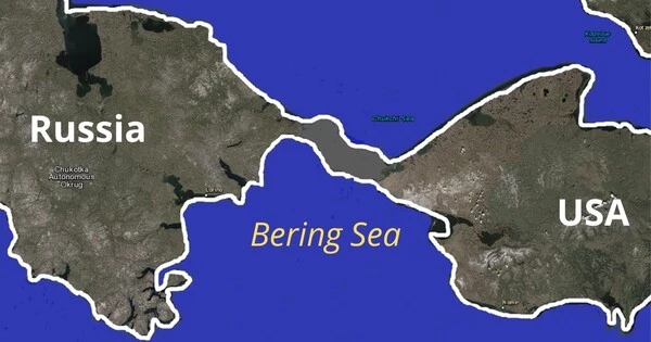
The Bering Land Bridge, also known as Beringia, was a land bridge that connected present-day Siberia and Alaska during the last ice age. It formed about 20,000 years ago, when sea levels were much lower due to the large amount of water that was locked up in the ice sheets. As the glaciers began to melt and sea levels rose, the Bering Land Bridge was eventually submerged, forming the Bering Strait.
The Bering Land Bridge played a significant role in human history, as it is believed to have been the route by which humans first migrated from Asia to North America. It is estimated that the first humans arrived in North America via the Bering Land Bridge around 15,000 years ago, during the Late Pleistocene period.
According to a new study that reconstructs the history of sea level at the Bering Strait, the Bering Land Bridge connecting Asia and North America did not appear until around 35,700 years ago, less than 10,000 years before the last ice age peaked (known as the Last Glacial Maximum).
The new findings, published in the Proceedings of the National Academy of Sciences, show that the expansion of the ice sheets – and the subsequent drop in sea level – occurred surprisingly quickly and much later in the glacial cycle than previous studies had suggested.
“It means that more than 50 percent of the global ice volume at the Last Glacial Maximum grew after 46,000 years ago,” said Tamara Pico, assistant professor of Earth and planetary sciences at UC Santa Cruz and a corresponding author of the paper. “This is important for understanding the feedbacks between climate and ice sheets, because it implies that there was a substantial delay in the development of ice sheets after global temperatures dropped.”
This is important for understanding the feedbacks between climate and ice sheets, because it implies that there was a substantial delay in the development of ice sheets after global temperatures dropped.
Tamara Pico
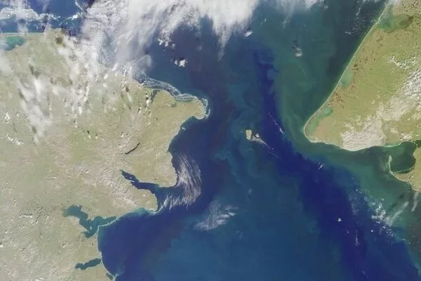
During ice ages, global sea levels fall as more and more of Earth’s water is trapped in massive ice sheets, but the timing of these processes has been difficult to pinpoint. Ice sheets covered large areas of North America during the Last Glacial Maximum, which lasted from about 26,500 to 19,000 years ago. Lower sea levels revealed a vast land area known as Beringia, which stretched from Siberia to Alaska and was home to herds of horses, mammoths, and other Pleistocene fauna. The Bering Strait has flooded again around 13,000 to 11,000 years ago as the ice sheets melted.
The new findings are interesting in relation to human migration because they shorten the time between the opening of the land bridge and the arrival of humans in the Americas. The timing of human migration into North America remains unresolved, but some studies suggest people may have lived in Beringia throughout the height of the ice age.
“People may have started going across as soon as the land bridge formed,” Pico said.
The new study used nitrogen isotopes in seafloor sediments to determine when the Bering Strait was flooded over the last 46,000 years, allowing water from the Pacific Ocean to flow into the Arctic Ocean. The isotope analysis was led by Princeton University’s Jesse Farmer, who measured nitrogen isotope ratios in the remains of marine plankton preserved in sediment cores collected from the seafloor at three locations in the western Arctic Ocean. Farmer was able to identify a nitrogen isotope signature indicating when Pacific water flowed into the Arctic due to differences in the nitrogen composition of Pacific and Arctic waters.
Pico, who specializes in sea level modeling, then compared Farmer’s findings to sea level models based on various scenarios for the growth of the ice sheets.
“What excites me is that this provides a completely independent constraint on global sea level during this time period,” Pico said. “Some of the proposed ice sheet histories differ quite a bit, and we were able to look at what the predicted sea level would be at the Bering Strait and see which ones are consistent with the nitrogen data.”
The results support recent studies indicating that global sea levels were much higher prior to the Last Glacial Maximum than previous estimates had suggested, she said. The average global sea level during the Last Glacial Maximum was about 130 meters (425 feet) lower than today. The actual sea level at a particular site such as the Bering Strait, however, depends on factors such as the deformation of the Earth’s crust by the weight of the ice sheets.
“It’s like punching down on bread dough; the crust sinks beneath the ice and rises around the edges,” Pico explained. “Furthermore, because the ice sheets are so massive, they exert a gravitational pull on the water. I simulate those processes to see how sea level would change around the world, with a focus on the Bering Strait in this case.”
The findings suggest a complicated relationship between climate and global ice volume, as well as new avenues for research into the mechanisms underlying glacial cycles.


