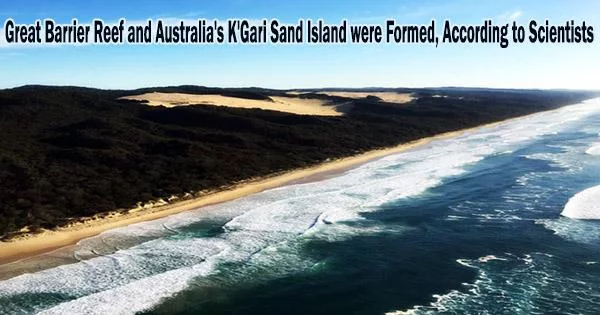
How did the Great Barrier Reef, the largest coral reef in the world, and K’gari, the indigenous name for eastern Australia’s Fraser Island, the largest sand island in the world, come to be? There is little known about how these UNESCO World Heritage sites came to be, despite the fact that they have been shaped by a stable, long-lasting tectonic history spanning the Quaternary period, which started 2.6 million years ago.
However, recent research by geoscientist Tammy Rittenour of Utah State University and a global group of colleagues points to a contemporary issue that may have contributed to the origins of the iconic landforms some 800,000 years ago: sea-level rise.
Rittenour and researchers from the University of Queensland, Australian National University, Flinders University, the University of Western Australia, the University of Canterbury, Clarkson University, and Stockholm University report the findings in the Nov. 14, 2022 issue of Nature Geoscience. The team’s research was supported by an Australian Research Council grant.
“Our research provides evidence that the formation of K’gari and the Great Barrier Reef are linked to a change in the magnitude of sea-level rise and fall due to major climate feedback changes during the Middle Pleistocene Transition,” says Rittenour, professor in USU’s Department of Geosciences and the Ecology Center.
We found that the sand island and dune fields first formed 1.2-0,7 million years ago, during a period of climate reconfiguration, when increasing global ice volume caused sea-level fluctuations that redistributed sediment previously stored on the continental shelf. The formation of K’gari prevented the transport of sand northward along the coast, into the areas that now host the Great Barrier Reef.
Tammy Rittenour
Rittenour, director of the USU Luminescence Laboratory, used optically stimulated luminescence dating to constrain the time of formation of the island’s extensive, vividly colored sand dunes as well as those from the nearby Cooloola Sand Mass using sediment samples from hand cores and beach bluffs.
“We found that the sand island and dune fields first formed 1.2-0,7 million years ago, during a period of climate reconfiguration, when increasing global ice volume caused sea-level fluctuations that redistributed sediment previously stored on the continental shelf,” Rittenour says. “The formation of K’gari prevented the transport of sand northward along the coast, into the areas that now host the Great Barrier Reef.”
The outward-jutting orientation of the massive sand island created conditions for the crystal-clear water needed for coral growth, allowing the development of the Great Barrier Reef.
“These significant findings are changing the way we look at coastal sedimentary systems,” Rittenour says. “This wholesale change in coastal conditions during the middle Pleistocene is probably not unique to eastern Australia’s coast and should be investigated in other passive-margin coastlines around the world.”