We live on a dynamic planet that is constantly in motion at multiple scales, from changing daily weather patterns to the shifting of massive tectonic plates. Despite this, the Earth’s geological activity is highest in areas where these tectonic plates collide, known as subduction zones.
Subduction zones, where one tectonic plate slides beneath another, produce the most devastating seismic, volcanic, and landslide hazards on the planet. A new report proposes an ambitious plan to make significant advances in understanding subduction zone hazards by bringing together a diverse community of scientists in a long-term collaborative effort, deploying new instrumentation in subduction zones, and developing more sophisticated and accurate models.
The report from the Subduction Zones in Four Dimensions (SZ4D) Research Coordination Network took years to complete. The National Science Foundation (NSF) funded the Research Coordination Network to develop a detailed plan after a 2016 workshop produced a “Vision Document” for the initiative. The SZ4D initiative identified community priorities as well as the key infrastructure requirements and science activities needed to better understand geohazards and reduce their risks to society through a series of meetings, workshops, webinars, and town halls to engage and solicit input from the US research community.
The new report’s implementation plan will inform ongoing discussions with the NSF and other agencies about funding for the initiative.
It’s a difficult problem, and solving it necessitates piecing together many different pieces. Individual scientists cannot focus solely on their individual pieces. We need the infrastructure, the science, and the organizational structure to put all the puzzle pieces together.
Emily Brodsky
“It’s been a huge community effort,” said Emily Brodsky, chair of the SZ4D steering committee and professor of Earth and planetary sciences at UC Santa Cruz. “This is the time to devote serious resources to determine whether these events are predictable or not. That is something we are about to address.”
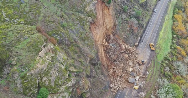
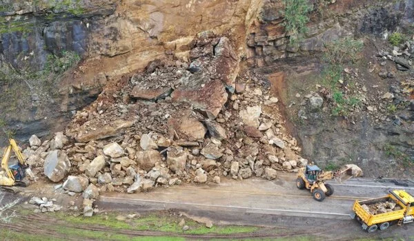
Subduction zones can be found all over the world, mostly along coastlines where an oceanic plate submerges beneath a continental plate. The resulting geohazards include the most powerful earthquakes and tsunamis, active volcano chains, and large landslides. Many major population centers are located along subduction zones, making them vulnerable to these hazards.
In the United States, the greatest risk is associated with the Cascadia subduction zone off the coast of the Pacific Northwest. According to Brodsky, however, Cascadia is not the best place to concentrate research efforts because it moves so slowly. The Chilean subduction zone is geologically active enough to provide useful information and is a good locale for comparative studies with Cascadia and Alaska. The SZ4D implementation plan recommends deploying instruments at all three sites, but with most of the observational efforts in Chile (70% of the instrumentation), along with a substantial portfolio of scientific activities in Cascadia and Alaska.
“We want to be able to translate what we learn in Chile to Cascadia and Alaska,” Brodsky explained. She said the initiative has already begun building partnerships with Chilean scientists and international groups studying the subduction zone there.
The implementation plan entails a significant effort to improve observations of subduction zones in a systematic manner, collecting a diverse set of measurements at a variety of temporal and spatial scales both on land and beneath the sea. The infrastructure required for this includes extensive arrays of instruments to monitor various aspects of subduction zone behavior, as well as volcanoes and surface and environmental conditions related to landslides. Furthermore, the plan calls for researchers to investigate the geologic context, conduct laboratory experiments, and develop computational models that integrate field observations and laboratory data.
The plan also emphasizes the importance of close coordination among all program components and deep integration. The initiative brings together a diverse group of scientists and stakeholders with a variety of geoscience backgrounds and expertise in earthquakes, volcanoes, and surface processes.
“It’s a difficult problem, and solving it necessitates piecing together many different pieces. Individual scientists cannot focus solely on their individual pieces” said Brodsky. “We need the infrastructure, the science, and the organizational structure to put all the puzzle pieces together.”
Major advances in understanding the science behind subduction zone hazards could result in tangible benefits for communities in affected areas, such as the possibility of useful forecasts of large earthquakes, volcanic eruptions, and landslides.
“We’re not promising anything, but we need to figure out if our inability to predict these things is related to the fundamental properties of the system, or if we just haven’t had the instruments in the right place at the right time,” Brodsky said.