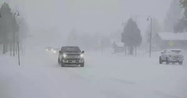
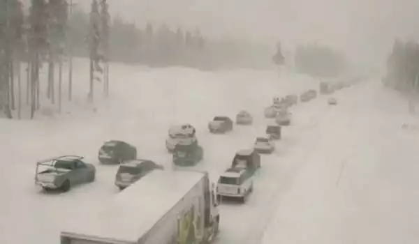
A new study aims to enhance the forecasting of brief but heavy rainstorms that can produce disastrous flash floods and landslides. Intense rain associated with narrow cold-frontal rainbands may last only a few minutes at a time, but it can create catastrophic flash flooding, debris flows, and landslides, and it can occur in conjunction with tornadoes and severe thunderstorms.
The storms, known as narrow cold-frontal rainbands, are long strips of rain that can span tens to hundreds of kilometers yet are just a few kilometers wide. They form along many of the world’s coasts, including both of the United States’ coasts.
Intense rain associated with narrow cold-frontal rainbands may last only a few minutes at a time, but it can create catastrophic flash flooding, debris flows, and landslides, and it can occur in conjunction with tornadoes and severe thunderstorms. With all of these possible threats, storms can cause widespread evacuations. However, predicting when and where the severe rain will hit and produce risks is difficult, and evacuations can be issued over a wide area. Improving forecasts of these atmospheric occurrences is critical for minimizing evacuation fatigue and preserving public trust in warning systems.
A new study examines three decades of radar and hazard-warning data from southern California to create a library of rainbands that will aid in predicting when and where these events may be deadly. The study was published in Geophysical Research Letters, an AGU publication that publishes high-impact, short-format reports with direct relevance in the Earth and space disciplines.
Researchers discovered that 60 percent of these events resulted in at least one National Weather Service alert from 1995 to 2020, with 15 of the 94 incidents resulting in 10 or more warnings as the bands raced across southern California. Some of the most violent catastrophes were linked to atmospheric rivers. And the majority occurred during the region’s already damp winter months of January through March.
Narrow cold-frontal rainbands produce some of the highest rainfalls of any extra-tropical cyclone precipitation band. The dangers vary depending on where you are, but the crucial component of the equation is a lot of rain in a short period of time.
Brian Collins
The new rainband catalog will aid scientists in developing storm prediction and tracking algorithms, with the ultimate goal of “nowcasting” storms: forecasting their patterns and hazards just a few hours in advance. According to research co-author Nina Oakley, an atmospheric scientist at the Scripps Institution of Oceanography, improving predictions is critical to assisting individuals who reside in potentially affected areas.
“Our present predictive algorithms struggle with event location, timing, and severity, and we need to enhance this for evacuation alerts. … If we issue evacuation warnings for what turns out to be a low-impact incident, we begin to experience evacuation fatigue, and people may lose trust in the warnings in the future “Oakley explains.
Searching the clouds
To determine how frequently, when, and where the rainbands occur, the researchers painstakingly scrutinized years of radar data, looking for telltale “gap and core” patterns of these rainbands, and coupled their findings with National Weather Service hazard warnings from the same time period.
They discovered that the number of narrow cold-frontal rainband episodes varied greatly, from none to roughly a dozen per year, with the majority occurring between January and March. Between 1995 and 2020, almost 60% of the occurrences resulted in at least one National Weather Service alert, and 15 especially powerful storms resulted in 10 or more warnings of flash floods, tornadoes, or debris flow and landslide risk as they swept across Southern California.
“With the exception of two of these strong rainband events, all but two of our whole collection were related with atmospheric rivers,” explains Marian de Orla-Barile, main study author and Ph.D. student in geography at the University of California, Santa Barbara. Rainbands were also typically connected with high water vapor content in the atmosphere and increasing low-pressure systems.
“Narrow cold-frontal rainbands produce some of the highest rainfalls of any extra-tropical cyclone precipitation band,” says Brian Collins, a USGS geomorphologist who was not involved in the research. “The dangers vary depending on where you are, but the crucial component of the equation is a lot of rain in a short period of time.”
Predicting disaster
Collins’ observation of a limited timescale underscores one of the difficulty in estimating damage. The study’s inventory of narrow cold-frontal rainbands is an important first step toward developing an algorithm that can automatically identify and track areas of strong, potentially dangerous rain. An algorithm of this type is at the basis of “nowcasting,” which seeks to forecast rainfall within hours. Eventually, as the algorithm and database improve, predicting storm trajectories and impacts will be possible.
Because rainbands can increase or weaken over time, especially when they reach mountainous terrain, it is difficult to predict when and where they will deliver the most severe rainfall and pose problems. Not all narrow cold-frontal rainbands cause catastrophic rainfall, nor do they all travel over a populated area below a recent wildfire burn scar or landslide hazard area that requires evacuation.
“Because of the uncertainty in where the rain band will have that high-intensity precipitation, warnings are frequently issued for vast areas. As a result, you wind up warning a broader region than is necessary “Collins explains. Collins emphasizes the importance of taking local factors into account, such as recent wildfires or strong rains that may have saturated the soil, making slopes prone to landslides, when projecting narrow cold-frontal rainband hazard concerns.
“With expected increases in wildfires as well as projected intensification of short-duration rainfall, it’s likely that in a warmer climate, there will be increasing post-fire debris flow occurrences,” adds de Orla-Barile, some of which could be coupled with narrow cold-front rainbands.


